Hidden Falls
Boulder County, Colorado
Your visit at a glance
- Waterfall height
- Not recorded
- Location
- Boulder County, Colorado
- Access status
- Partial guide: winter climbing approach only; exact distance and summer route unknown
- The walk
- Exact distance unconfirmed
- Ground & access
- Snowshoes or spikes may be needed in winter. The falls is a popular ice climb; stay clear of climbers and falling ice. No pets on RMNP trails.
SummitPost describes driving the Wild Basin road as far as it is plowed, parking, and walking toward the falls. After the sign for Upper and Lower Copeland Falls, continue on the path until the column of Hidden Falls is visible. The Colorado Mountain Club says the route follows the North St. Vrain Creek trail past Copeland Falls. Return the same way.
Plan your visit
Wild Basin road or winter trailhead past the Copeland Falls sign to Hidden Falls
The Colorado Mountain Club lists Hidden Falls as 4.4 miles with 500 feet of gain, but it is not clear whether that is measured from the winter gate or the summer trailhead. No measured summer distance found.
Snowshoes or spikes may be needed in winter. The falls is a popular ice climb; stay clear of climbers and falling ice. No pets on RMNP trails.
Where to start
Wild Basin road; in winter the road is gated about a mile before the Wild Basin Trailhead and visitors park at the winter trailhead.
Timing & water
Sources describe winter visits when the falls is frozen. Summer approach not documented.
Before you go
RMNP entrance pass required: $30 per private vehicle for one day or $35 for seven days. From May 22 to October 12, 2026, a Timed Entry reservation was needed to enter between 9 a.m. and 2 p.m., including for Wild Basin.
Visitor informationVisit sources
More waterfalls nearby
Within 40 straight-line miles. Road and trail distances will differ.
- Upper Copeland FallsPublished trail route and trailhead parking documented; park entry rules applyBoulder County, CO0.2 miNE
- Lower Copeland FallsPublished trail route and trailhead parking documented; park entry rules applyBoulder County, CO0.3 miNE
- Copeland FallsPublished trail distance and park entry rules documentedBoulder County, CO0.5 miNE
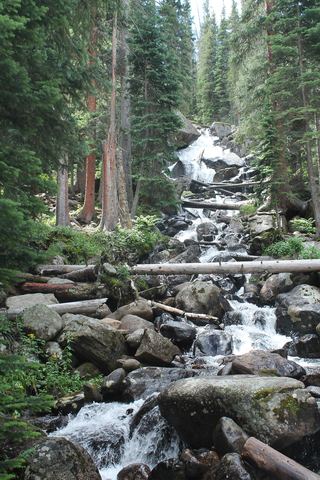 Calypso CascadesOfficial trail distance and park entry rules documentedBoulder County, CO0.9 miSW
- Ouzel FallsPublished trail route and trailhead parking documented; park entry rules applyBoulder County, CO1.3 miW
- Lyric FallsPartial guide: last 0.75 mile is an unmaintained social trail with no markerBoulder County, CO1.9 miNW
- Mertensia FallsBoulder County, CO3.5 miW
- Thunder FallsBoulder County, CO3.8 miNW
- Trio FallsBoulder County, CO4.2 miNW