Marble Falls
Tulare County, California
Your visit at a glance
- Waterfall height
- Not recorded
- Location
- Tulare County, California
- Access status
- Official trail; NPS distance figures differ
- The walk
- About 6.2 to 7.8 miles return (NPS pages give 3.1 and 3.9 miles one way)
- Ground & access
- Steady climb through hot, exposed chaparral. Rivers are dangerous at high water.
Park near site 14 at Potwisha Campground in Sequoia National Park, follow the dirt road across the concrete ditch, and start up the steep bank on the right. The trail climbs through chaparral to a waterfall cascade. Return the same way.
Plan your visit
Potwisha Campground (near site 14) on the Marble Falls Trail to the cascade
One NPS page gives 3.1 miles one way and another gives 3.9 miles. Return distance is derived by doubling each figure.
Steady climb through hot, exposed chaparral. Rivers are dangerous at high water.
Where to start
Near site 14 at Potwisha Campground, with more parking in the Potwisha Overflow lot across the Generals Highway.
Timing & water
Foothill trails are open year round; summer is hot.
Before you go
Pets are not permitted on any trails in Sequoia and Kings Canyon. Park entrance rules apply.
Visitor informationVisit sources
More waterfalls nearby
Within 40 straight-line miles. Road and trail distances will differ.
- Panther Creek FallsPartial guide: viewing spot for the falls not described154 ft (47 m) · Tulare County, CA4.1 miE
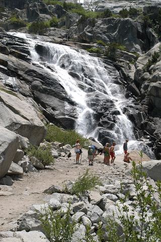 Tokopah FallsResearched visit notesTulare County, CA6.7 miNE
- Lower Buck Creek FallsTulare County, CA7.1 miE
- Upper Buck Creek FallsTulare County, CA9.4 miE
- Lower Cliff Creek FallsTulare County, CA12 miE
- Upper Cliff Creek FallsTulare County, CA12 miE
- Tamarack Falls52 ft (16 m) · Tulare County, CA13 miE
- Tufa FallsPartial guide: falls are above the trail and screened by foliage; a clear viewpoint is not confirmedTulare County, CA13 miSE
- Viola FallsPartial guide: route from non-NPS guides; Sunset Trail partly closed for October 2026 prescribed fireTulare County, CA16 miNW