Middle Fork Falls
Fremont County, Wyoming
Your visit at a glance
- Waterfall height
- Not recorded
- Location
- Fremont County, Wyoming
- Access status
- National forest trail from Bruce's Parking Area in Sinks Canyon to the falls
- The walk
- 4.1 miles round trip per Hiking Project
- Ground & access
- Well-maintained dirt path at first, then roots and loose rocks after the junction; about 864 feet of climbing on the round trip. The river is dangerous during peak snowmelt in June and early July.
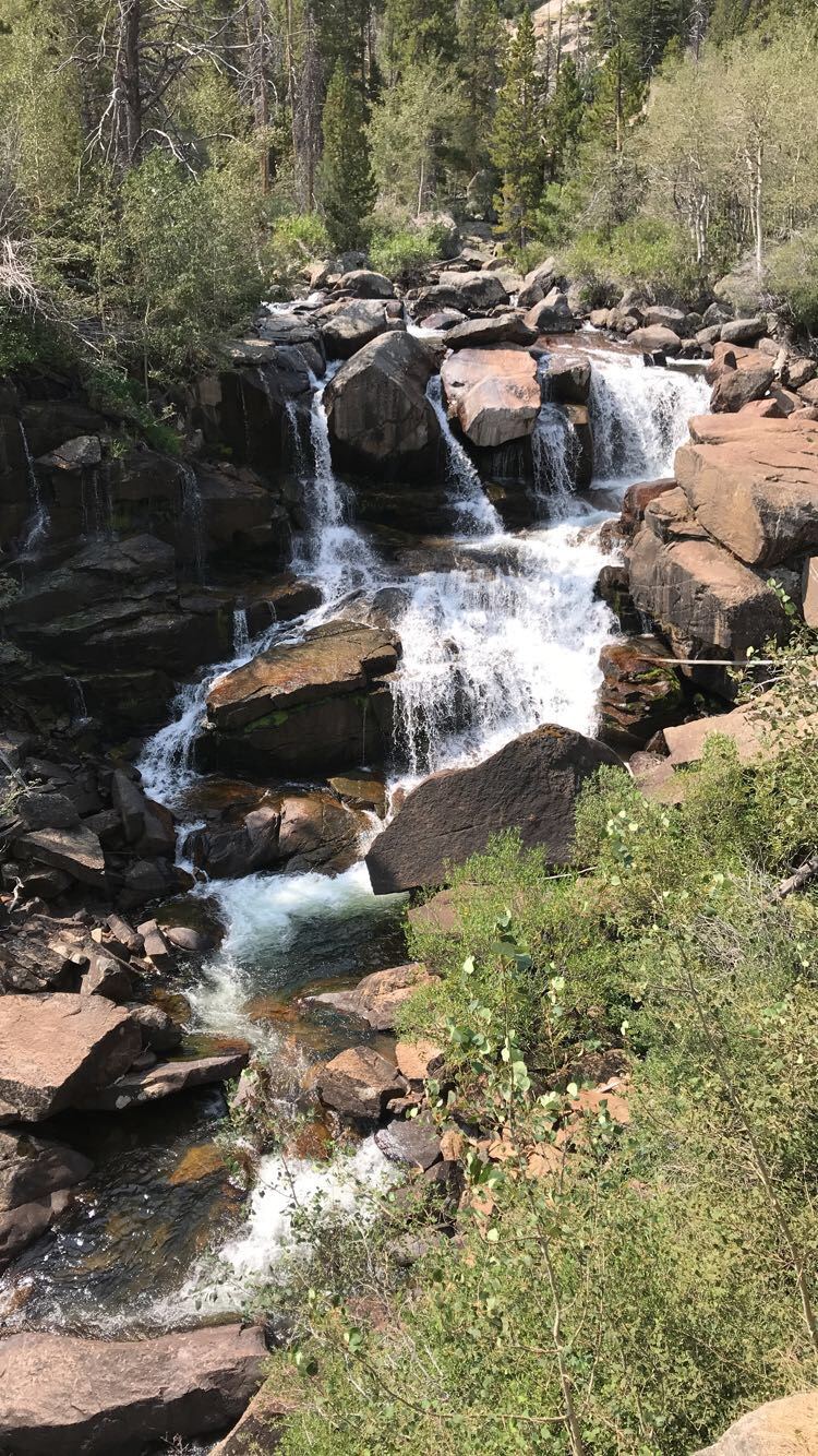
Middle Fork Falls, usually called Popo Agie Falls, is a series of cascades on the Middle Popo Agie River in the Shoshone National Forest above Sinks Canyon, southwest of Lander. Park in the large lot at Bruce's Parking Area and cross the footbridge to the trailhead kiosk. Go left on the Middle Fork Trail, which follows the river southwest. At the trail junction, the right branch leads to the Middle Fork Trail and Stock Connector; take the left branch to the falls. The trail becomes rougher, crosses another footbridge, passes an overlook of Sinks Canyon and climbs a small hill to the falls. A lower side trail leads to a waterslide and swimming hole that is very dangerous at peak snowmelt. Return the same way.
Plan your visit
Bruce's Parking Area on Sinks Canyon Road, footbridge over the river to the trailhead kiosk, the Middle Fork Trail up the Middle Popo Agie River, then the left fork at the junction to the falls
Hiking Project lists the Popo Agie Falls route as 4.1 miles out and back with 864 feet of climbing. 10Adventures gives 5.3 km return.
Well-maintained dirt path at first, then roots and loose rocks after the junction; about 864 feet of climbing on the round trip. The river is dangerous during peak snowmelt in June and early July.
Where to start
Bruce's Parking Area on Sinks Canyon Road, about 3 miles up the road from the Sinks Canyon State Park Visitor Center; large lot on the left.
Timing & water
10Adventures suggests March to October. Hiking Project warns that the river and swimming hole are dangerous during peak snowmelt, June to early July.
Before you go
No fee is mentioned.
Visitor informationVisit sources
More waterfalls nearby
Within 40 straight-line miles. Road and trail distances will differ.