Beaver Falls
Columbia County, Oregon
Your visit at a glance
- Waterfall height
- 233 ft (71 m)
- Location
- Columbia County, Oregon
- Access status
- Short trail and parking pullout documented
- The walk
- About 0.7 mile round trip
- Ground & access
- Short graded forest trail with switchbacks. Poison oak near the trail. Rocks behind the falls are very slippery. The Survey notes the last section has been prone to slides and the trail has been closed at times after damage.
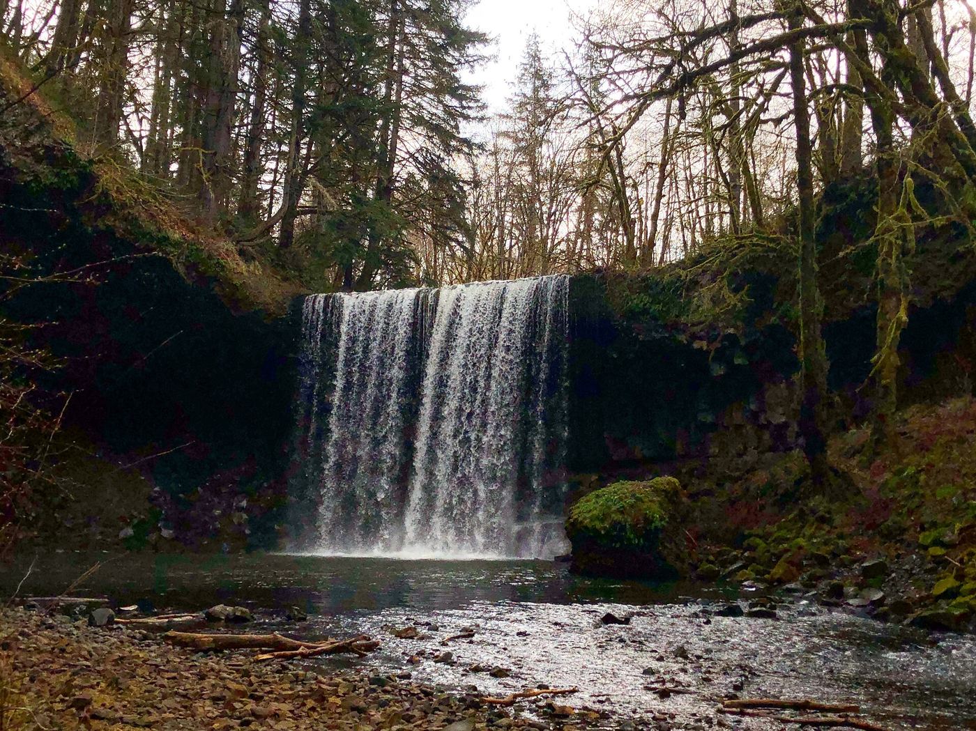
From the gravel pullout, the trail descends two switchbacks through forest, then undulates along the slope past a rock face and a poison oak warning sign before dropping to the cobbled shore of the plunge pool below Beaver Falls. Return the same way. A fence along the road blocks the old scramble route; use the trail.
Plan your visit
Beaver Falls Trailhead on Beaver Falls Road to the base of the falls
Oregon Hikers gives 0.7 mile round trip with 100 feet of elevation gain. The Northwest Waterfall Survey describes about a quarter mile to the base.
Short graded forest trail with switchbacks. Poison oak near the trail. Rocks behind the falls are very slippery. The Survey notes the last section has been prone to slides and the trail has been closed at times after damage.
Where to start
Large gravel pullout on the left side of Beaver Falls Road (old Highway 30), 1.9 miles past the Upper Beaver Falls pullout. Beaver Falls Road leaves Highway 30 on a narrow exit to the right about 4.7 miles west of the Lewis and Clark Bridge underpass.
Timing & water
Oregon Hikers lists the trail as open all year. Flow is best in the rainy season, usually December through April.
Before you go
No fee is mentioned.
Visitor informationVisit sources
More waterfalls nearby
Within 40 straight-line miles. Road and trail distances will differ.
- Marietta FallsCowlitz County, WA17 miE
- Barrier FallsSigned hatchery nature trail to a creek viewpointClatsop County, OR18 miW
- Stillwater FallsCowlitz County, WA19 miN
- Lower Kalama River FallsCowlitz County, WA20 miE
- Bonnie FallsPartial guide: roadside view from the highway right-of-way; land status at the falls is not statedColumbia County, OR23 miSE
- Fishhawk FallsResearched walking routeClatsop County, OR24 miSW
- Jenny Creek FallsClark County, WA26 miSE
- Grist Mill FallsClark County, WA28 miSE
- Marble Creek FallsClark County, WA29 miE