Turner Falls
Murray County, Oklahoma
Your visit at a glance
- Waterfall height
- 79 ft (24 m)
- Location
- Murray County, Oklahoma
- Access status
- Researched walking route
- The walk
- Distance not verified
- Ground & access
- Creekside path shown on the map; precise surface, grade and accessibility are not established.
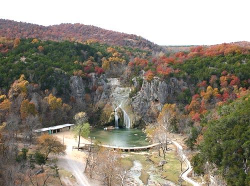
Photo credit
Photo: Original uploader was Emersonbiggins85 at en.wikipedia, CC BY-SA 3.0, via Wikimedia CommonsCity-owned park with waterfall viewing and seasonal swimming. Swimming is closed for winter as checked October 27, 2026.
Plan your visit
The park map shows the waterfall and pool in Level 1, with a creekside trail connecting toward the Level 1 parking and castle area. Use the park map and designated paths to the waterfall viewing area.
The map labels other hiking trails but does not give a Level 1 parking-to-waterfall return distance.
Creekside path shown on the map; precise surface, grade and accessibility are not established.
Where to start
Level 1 is the closest parking to the waterfall according to the park. On summer weekends and holidays it is a paid VIP option; Level 3 parking is free but farther away.
Timing & water
Winter October–April: entry 8 a.m. to sunset. Summer May–September: entry 7 a.m. to sunset. Closed Thanksgiving and Christmas.
Before you go
Admission is required separately. Advance purchase of summer weekend/holiday VIP parking is recommended by the park; current rates are on its parking page.
Visitor informationVisit sources
More waterfalls nearby
Within 40 straight-line miles. Road and trail distances will differ.
- Bridal Veil FallsMurray County, OK0.0 miSW
- Price’s FallsMurray County, OK2.4 miE
- Henry House FallsCarter County, OK7.1 miSW
- Hickory FallsCarter County, OK9.4 miSW
- Sycamore FallsPartial guide: public trail along the creek; the viewing spot for this falls is not describedMurray County, OK12 miNE
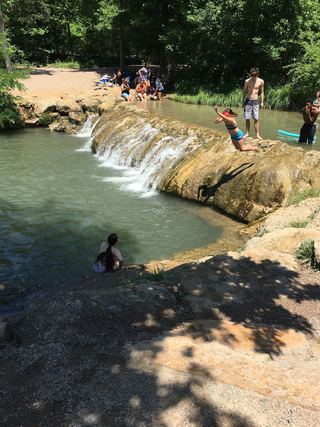 Little Niagara FallsNational recreation area roadside falls; freeMurray County, OK12 miNE