Horseshoe Mines Falls
Ulster County, New York
Your visit at a glance
- Waterfall height
- Not recorded
- Location
- Ulster County, New York
- Access status
- Short unmarked path and roadside parking documented
- The walk
- About 100 yards one way from the railroad bed
- Ground & access
- Short, easy, unmarked path. The mine opening below the falls is hazardous.
Take US 209 to Spring Glen, turn east on Old Mountain Road and immediately left on Lewis Road. Drive about 0.8 miles, past Spring Glen Campground, to an old stone bridge over a small stream on the right; pull over just past it on the left. Walk up to the old railroad bed to the left of the stream and bridge, cross the bed without crossing the bridge, and follow the unmarked path upstream, keeping the stream on your right as you walk upstream. The 60- to 70-foot falls end in a drop over the opening of an old mine tunnel. Enter the mine only at your own risk.
Plan your visit
Lewis Road shoulder past Spring Glen Campground, old railroad bed beside a stone bridge, then a path upstream to Horseshoe Mine Falls
Uncovering New York gives about 100 yards of easy hiking from the old railroad bed to the base of the falls.
Short, easy, unmarked path. The mine opening below the falls is hazardous.
Where to start
Gravel shoulder on Lewis Road, room for a couple of cars on the left just past the stone bridge (Uncovering New York coordinates 41.668821, -74.415853). There are no signs for the falls.
Timing & water
Flow is best in snowmelt and after rain.
Before you go
NYFalls places the falls in Shawangunk Ridge State Forest. No fee is stated by the sources.
Visitor informationVisit sources
More waterfalls nearby
Within 40 straight-line miles. Road and trail distances will differ.
- Nevele Falls36 ft (11 m) · Ulster County, NY2.1 miNE
- North Gully FallsUlster County, NY3.1 miNE
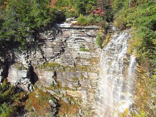 Verkeerderkill FallsLong Path to a landowner-permitted overlook; trail beyond the overlook is closedUlster County, NY4.6 miE
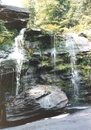 Hanging Rock FallsPartial guide: informal path; land ownership and parking permission not statedUlster County, NY5.1 miN
- Witches Hole WaterfallUlster County, NY5.3 miNE
- Stony Kill FallsState park trail with steps and footbridges; parking on Shaft 2A RoadUlster County, NY7.1 miNE
- Mine Hole Falls23 ft (7 m) · Ulster County, NY7.1 miNE
- Rainbow FallsState park carriage road and footpath; seasonal flowUlster County, NY7.8 miNE
- Little Stony Kill FallsUlster County, NY7.8 miNE