Waterfalls near Woonsocket, RI
8 named waterfalls within 30 miles of Woonsocket, closest first. Distances are straight-line from the town center.
Visits with route details
Read the walking route, starting point and current access notes.
- Cascade Brook FallsConservation area trail and parking documentedProvidence County, RI
- Ponogansett FallsPartial guide: roadside view of a dam spillway; parking and listing match not confirmedProvidence County, RI
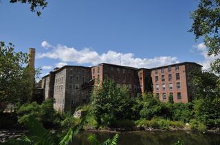 Cargill FallsPublic river trail and parking documented; distance from a specific lot not statedWindham County, CT
- Rock FallsTown walkway and boardwalk to a viewing platform; easyNorfolk County, MA
- Stepstone FallsShort path from a parking area on Falls River RoadKent County, RI
All 8 waterfalls
- Cascade Brook FallsConservation area trail and parking documentedProvidence County, RI9.0 miS
- Ponogansett FallsPartial guide: roadside view of a dam spillway; parking and listing match not confirmedProvidence County, RI17 miSW
- Cargill FallsPublic river trail and parking documented; distance from a specific lot not statedWindham County, CT21 miW
- Payne's Pond Falls7 ft (2 m) · Kent County, RI24 miS
 East Greenwich Falls25 ft (7.5 m) · Kent County, RI24 miS
- Spencer Rock WaterfallKent County, RI25 miSW
- Rock FallsTown walkway and boardwalk to a viewing platform; easyNorfolk County, MA30 miNE
- Stepstone FallsShort path from a parking area on Falls River RoadKent County, RI30 miSW