Deadwood Falls
Glacier County, Montana
Your visit at a glance
- Waterfall height
- Not recorded
- Location
- Glacier County, Montana
- Access status
- Published trail route documented
- The walk
- About 2.4 miles return
- Ground & access
- Forest trail, steady descent on the way in and a 665-foot climb out. Prime bear habitat.
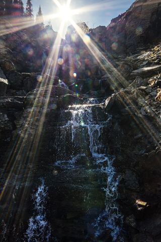
From the trailhead at the eastern end of the Jackson Glacier Overlook parking area on Going-to-the-Sun Road, hike south and downhill toward the Reynolds Creek Backcountry Campground. After about 1.1 miles the creek comes into view; a little further is Deadwood Falls, a 10-foot waterfall with deep pools. The Gunsight Pass Trail junction is about a tenth of a mile beyond. The climb back gains about 665 feet.
Plan your visit
Jackson Glacier Overlook trailhead down toward Reynolds Creek to Deadwood Falls
Hiking in Glacier says Reynolds Creek comes into view about 1.1 miles from the trailhead and the falls are a little further, with a 665-foot drop in under 1.2 miles. Return figure doubled from about 1.2 miles.
Forest trail, steady descent on the way in and a 665-foot climb out. Prime bear habitat.
Where to start
Jackson Glacier Overlook pullout on Going-to-the-Sun Road, 12.6 miles west of the St. Mary Entrance Station.
Timing & water
Snow-free season, roughly summer to early fall. Road and trail openings vary; check NPS road and trail status.
Before you go
Glacier National Park entrance pass required; NPS lists $35 per private vehicle for 7 days ($25 winter rate, November 1 to April 30). NPS says no vehicle reservations are required in 2026.
Visitor informationMore waterfalls nearby
Within 40 straight-line miles. Road and trail distances will differ.
- Saint Mary FallsOfficial NPS trail; seasonal road access unverifiedGlacier County, MT1.0 miE
- Lower Virginia FallsPartial guide: official route reaches Virginia Falls, but the view of the lower tier is not confirmedGlacier County, MT1.2 miE
- Upper Virginia FallsPartial guide: official route reaches Virginia Falls, but the view of the upper tier is not confirmedGlacier County, MT1.2 miE
- Baring FallsOfficial NPS trail; seasonal road access unverified25 ft (7.7 m) · Glacier County, MT2.1 miE
- Florence FallsPublished trail route documentedGlacier County, MT2.8 miSW
- Piegan FallsSource-reviewed route and parkingGlacier County, MT3.5 miNW
- Siksika FallsGlacier County, MT4.1 miSW
 Oberlin FallsGlacier County, MT4.6 miNW
- Morning Eagle FallsDocumented walking approach; autumn bridge conditions unverified and boats closed for 2026Glacier County, MT5.5 miNW