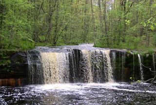
Big Spring Falls
Pine County, Minnesota
Your visit at a glance
- Waterfall height
- Not recorded
- Location
- Pine County, Minnesota
- Access status
- Official state park trail; bridge closure noted on map
- The walk
- About 0.8 mile return
- Ground & access
- Mostly flat, packed dirt. The DNR says the trail can be very wet in spring.
Drive through Sandstone to the southern unit of Banning State Park. Walk the Big Spring Falls Trail along the Kettle River to views of an island with the falls on one side and rapids on the other. Return the same way. The DNR map notes the trail segments are one-way because of a bridge closure.
Plan your visit
Big Spring Falls Trail in the southern unit of Banning State Park
The DNR park map lists the Big Spring Falls Trail as 0.4 miles one-way, so about 0.8 mile return. A DNR virtual tour gives about 3/4 mile roundtrip.
Mostly flat, packed dirt. The DNR says the trail can be very wet in spring.
Where to start
Park in the Banning State Park southern unit, reached through Sandstone. The sources do not give the exact lot location.
Timing & water
The DNR notes a bridge closure that makes the two trail segments one-way. Check with the park for current trail status.
Before you go
A Minnesota state park vehicle permit is required to park.
Visitor informationMore waterfalls nearby
Within 40 straight-line miles. Road and trail distances will differ.