Keown Falls South 25
Walker County, Georgia
Your visit at a glance
- Waterfall height
- Not recorded
- Location
- Walker County, Georgia
- Access status
- Published trail route and trailhead parking documented; low flow most of the year
- The walk
- About 0.75 miles each way, about 1.5 miles return
- Ground & access
- Fairly steep switchbacks. The falls usually have very low flow except after heavy rain. Stay off side paths to the cliff tops.
South Keown Falls is a 25-foot free-fall on a tributary beside Keown Falls in the Chattahoochee National Forest. From the far end of the parking area, the trail splits into the Keown Falls Loop at 0.1 mile. Stay left and climb the switchbacks up Johns Mountain. The trail enters Keown Falls Cove at about 0.65 miles and reaches South Keown Falls at 0.75 miles. Keown Falls is at 0.9 miles. Return the same way or finish the loop.
Plan your visit
Keown Falls trailhead at the end of FS 702 to South Keown Falls on the south side of the Keown Falls Loop
Hiking the Appalachians reaches South Keown Falls at 0.75 miles from the trailhead by the south side of the loop. The return figure is derived by doubling it. Keown Falls is 0.15 miles farther.
Fairly steep switchbacks. The falls usually have very low flow except after heavy rain. Stay off side paths to the cliff tops.
Where to start
Trailhead parking lot at the end of gravel Forest Service Road 702, 0.6 mile off Everett Springs Road (Pocket Road). From Calhoun, take GA 136 Connector north 5.6 miles, Lake Marvin Road 7 miles, then right 2.5 miles to FS 702.
Timing & water
Best in spring or fall during wet periods; the falls are often a trickle.
Before you go
The trail report lists no fees.
Visitor informationVisit sources
More waterfalls nearby
Within 40 straight-line miles. Road and trail distances will differ.
- Keown Falls North 35Firsthand trail report with directions and distance30 ft (9 m) · Walker County, GA0.1 miNE
- Mill Creek Falls (2) 50Murray County, GA25 miNE
- Hemlock FallsResearched visit notes89 ft (27 m) · Dade County, GA27 miNW
- Cherokee FallsSource-reviewed route and parking59 ft (18 m) · Dade County, GA27 miNW
- Lula Lake Falls 30Partial guide: exact feature at Lula Lake unconfirmed; reservation days onlyWalker County, GA27 miNW
- Lula Falls 100Official route documented; reservation and fee required; limited open daysWalker County, GA27 miNW
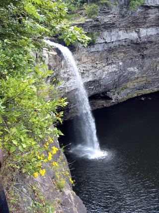 DeSoto FallsSource-reviewed route and parkingDeKalb County, AL28 miW
- High FallsPartial guide: inside a paid attraction; falls coordinates not confirmed by Rock City100 ft (30.5 m) · Walker County, GA29 miNW
- Lower Cascades Glen Falls 65Hamilton County, TN29 miNW