Nonnewaug Falls
Litchfield County, Connecticut
Your visit at a glance
- Waterfall height
- Not recorded
- Location
- Litchfield County, Connecticut
- Access status
- Visitor route and trailhead parking documented; unmarked junctions
- The walk
- About 1.3 miles in total for the visit
- Ground & access
- Easy woods roads and field edges with about 240 feet of total climbing. Reaching the base of the falls means a steep, wet, unstable slope. The far bank is private property; stay on the side you arrive on.
Nonnewaug Falls, also called Leever Falls, is an 18 to 20 foot drop in Woodbury town open space; the parking is in Bethlehem. From the lot at the end of Falls Road, go past the metal gate, cross the bridge, and take the left fork steeply uphill. At the top near the power lines bear right into the woods. At a T-junction turn left past two large oaks, cross the open field to the right, and at the fork with a red post go left downhill to the falls. The routes are not clearly marked.
Plan your visit
Falls Road parking area in Bethlehem to Nonnewaug Falls on woods roads
Scenes From The Trail gives approximately 1.3 miles for its lollipop loop and says its out-and-back route was about the same distance.
Easy woods roads and field edges with about 240 feet of total climbing. Reaching the base of the falls means a steep, wet, unstable slope. The far bank is private property; stay on the side you arrive on.
Where to start
Dirt and gravel lot for about 10 to 12 cars at the end of Falls Road, Bethlehem. The 2022 account lists no entrance or parking fee and no toilets.
Timing & water
Swimming is prohibited. Water flows most of the year; high water is best. Trail signs and markers were unreliable in 2022.
Before you go
No entrance or parking fee reported. No reservation.
Visitor informationVisit sources
More waterfalls nearby
Within 40 straight-line miles. Road and trail distances will differ.
- East Meadow Brook FallsLitchfield County, CT3.0 miSW
- CascadeLitchfield County, CT4.6 miE
- CascadeLitchfield County, CT6.0 miE
- Knife Shop FallsParking and informal paths described; exact drop not confirmed; no marked trailLitchfield County, CT7.0 miNE
- Buttermilk FallsVisitor route and parking documented; short walkLitchfield County, CT8.6 miE
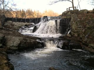 Southford FallsOfficial park location and free entry; short walk from the lot documentedNew Haven County, CT10 miS
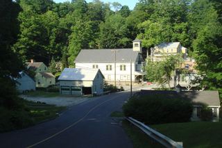 New Preston FallsPartial guide: village viewpoint documented; parking not confirmedLitchfield County, CT11 miNW
- Spruce Brook FallsNew Haven County, CT11 miSE
- Spruce Brook FallsPartial guide: which Spruce Brook drop this point marks is unconfirmed; 2024 flood damageNew Haven County, CT12 miSE