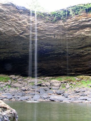
Salt Creek Falls
Talladega County, Alabama
Your visit at a glance
- Waterfall height
- Not recorded
- Location
- Talladega County, Alabama
- Access status
- Approach or parking partly unconfirmed
- The walk
- Less than half a mile one way in the firsthand description; exact length uncertain.
- Ground & access
- The top approach is shorter and easier than the cliff descent. Both accounts describe a difficult, slippery descent and climb out; no base approach is recommended here.
Colben Freeman’s Outbound account describes parking at a small roadside pull-off and walking past a vehicle-blocking dirt mound to the top of Salt Creek Falls. A separate firsthand account corroborates this start. These are visitor accounts, not current land-manager access confirmation.
Plan your visit
Informal path from Salt Creek Road pull-off to the top
Only the stated source distance is supported; mapped proximity is not a walking distance.
The top approach is shorter and easier than the cliff descent. Both accounts describe a difficult, slippery descent and climb out; no base approach is recommended here.
Where to start
The Outbound lists 118 Salt Creek Road near Munford and describes a small roadside pull-off. Do not navigate to the waterfall coordinates as if they were the parking area. Current authorized parking status remains unverified.
Timing & water
Current access and seasonal conditions require confirmation with the land manager.
Before you go
Unknown: current fees or reservation requirements were not established in the reviewed source.
Visitor informationVisit sources
More waterfalls nearby
Within 40 straight-line miles. Road and trail distances will differ.