WaterfallNear Me

Kansas waterfall visits

Compare 6 Kansas waterfall visits by the approach, terrain, and where to start. Some routes have closures or unresolved details; read the individual guide before travelling.

6 visit options

Elk Falls Waterfall, KS

Public bridge viewpoint; parking not described

Kansas

Elk Falls Waterfall

View from the pedestrian bridge; distance not published

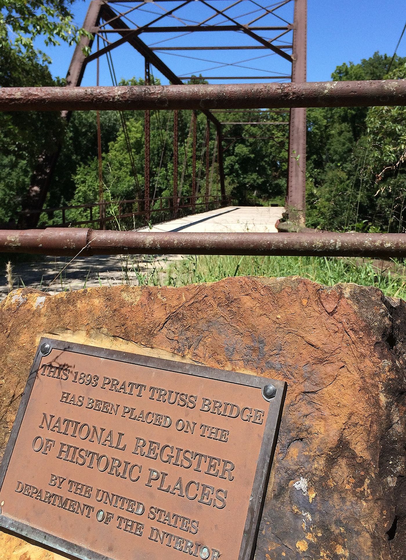
Elk Falls is a low, wide sandstone ledge waterfall on the Elk River at the east edge of the town of Elk Falls. The 1893 iron and wood truss bridge just downstream carried U.S. 160 until the mid-1970s and is now open for foot traffic. The Kansas Geological Survey says the waterfall is publicly accessible. A 2020 visitor account gives the location as 4th Street and Montgomery Street and says the falls are easily seen from the bridge.

Photo creditPhoto: Jon Roanhaus, CC BY-SA 3.0, via Wikimedia Commons

Partial guide: route documented; church lot parking permission not confirmed

Kansas

Angel Falls

About half a mile on a paved trail (published figure)

Angel Falls is a small waterfall on Sevenmile Creek behind St. Francis de Sales Catholic Church in Lansing, between Mary and Ida streets. The trailhead is on the east side of the church parking lot. Follow the paved trail; the falls can be seen from a bridge that overlooks them.

Location map; no photo available.

Spillway falls; roadside parking and short path

Kansas

Bourbon Falls

Short path; length not measured

Bourbon Falls drops over the spillway of Bourbon County State Lake (Bourbon State Fishing Lake) and is one of the larger waterfalls in Kansas when flowing. Park on the road just north of the falls and walk down a path to the falls.

Location map; no photo available.

Informal unmaintained path; permission not confirmed

Kansas

Cedar Lake Falls

A few hundred yards each way

Take 159th Street to the Access Road and follow it to its western end, where a gravel loop allows parking beside the lake. An unmarked, unmaintained path of a few hundred yards leads to the falls below the spillway. Expect overgrowth, mud and water.

Location map; no photo available.

Trailhead park and parking documented

Kansas

Turkey Creek Falls

Trailhead viewpoint; distance from the parking area not published

Kansas City Hiker says the northern trailhead of the Turkey Creek Streamway Trail is home to Turkey Creek Falls and suggests starting at Waterfall Park and heading south. The paved streamway runs about four miles south along Turkey Creek.

Location map; no photo available.

Below-dam river falls; drive-up parking and short walk

Kansas

Wakarusa River Falls

Short walk down to the river; length not measured

Wakarusa River Falls is a small falls on the Wakarusa River just below where it drains out of Clinton Lake near Lawrence, north of Eagle Bend Golf Course. Going north on E 902 Road, turn off just before the spillway and follow the drive to its end, then walk down to the river. It is a popular fishing spot.

Location map; no photo available.

Choose another state All mapped waterfalls in Kansas