Viola Falls
Greene County, New York
Your visit at a glance
- Waterfall height
- 30 ft (9 m)
- Location
- Greene County, New York
- Access status
- Forest Preserve trail past Poet's Ledge; about 3.7 miles one way
- The walk
- About 3.7 miles one way
- Ground & access
- Steady climb of about 1,600 feet on rocky trail. Mossy, slippery rocks at the falls; the way down to the base on the east side is steep. A 30-foot drop opens between rocks at Poet's Ledge. Bears are active here.
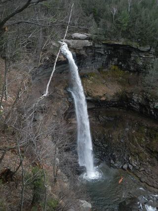
Viola Falls is a plunge of about 36 feet in Hillyer Ravine on the south rim of Kaaterskill Clove. From the Harding Road Parking Area, walk west on NY 23A to Malden Avenue and follow the trail past the barriers. Look for the Long Path marker and walk up the dirt driveway past a metal gate; the first part of the route crosses private land on the marked trail before reaching state land. Climb the escarpment past views to the junction at mile 2.63, go right on the yellow trail to Poet's Ledge at mile 3.07, and continue to the top of Viola Falls at mile 3.74. The trail runs across the top of the falls. Return the same way.
Plan your visit
DEC Harding Road Parking Area off NY 23A in Palenville, Malden Avenue, Long Path up the escarpment, yellow trail past Poet's Ledge to the top of Viola Falls
Catskill Mountaineer gives Viola Falls at mile 3.74 and the return to NY 23A at mile 7.48. DEC gives the Poet's Ledge trail as 3.6 miles with 1,661 feet of climb.
Steady climb of about 1,600 feet on rocky trail. Mossy, slippery rocks at the falls; the way down to the base on the east side is steep. A 30-foot drop opens between rocks at Poet's Ledge. Bears are active here.
Where to start
DEC Harding Road Parking Area off NY 23A in Palenville, coordinates 42.176236, -74.030495. Do not park at the trailhead, on Malden Avenue or by the red building next to the bridge, and do not drive up the private dirt road.
Timing & water
Catskill Mountaineer names the falls for violets that bloom in late October and early November. Flow is low.
Before you go
No fee is mentioned.
Visitor informationVisit sources
More waterfalls nearby
Within 40 straight-line miles. Road and trail distances will differ.
- Elizabeth Falls26 ft (8 m) · Greene County, NY0.0 miNE
- Wildcat FallsDEC trail crosses the top of the falls; base access dangerous98 ft (30 m) · Greene County, NY0.4 miNW
- Fawn's Leap26 ft (8 m) · Greene County, NY0.7 miN
- Buttermilk Falls75 ft (23 m) · Greene County, NY0.8 miNW
- Lower Buttermilk FallsPartial guide: bushwhack and creek crossing only safe at low water36 ft (11 m) · Greene County, NY1.1 miNW
- Santa Cruz Falls56 ft (17 m) · Greene County, NY1.5 miNW
- Bastion FallsPartial: falls location documented; no parking on Route 23A and the walk from the lots is not described33 ft (10 m) · Greene County, NY1.7 miN
 Kaaterskill FallsResearched visit notes148 ft (45 m) · Greene County, NY1.8 miN
- Delmura FallsPartial guide: bushwhack approach; final route to the falls not described in detail13 ft (4 m) · Greene County, NY2.1 miNW