Lower Minneopa Falls
Blue Earth County, Minnesota
Your visit at a glance
- Waterfall height
- 39 ft (12 m)
- Location
- Blue Earth County, Minnesota
- Access status
- Official state park waterfall trail with steep stairs; current closures unverified
- The walk
- About 0.4 mile return
- Ground & access
- Cement and dirt paths with steep stairs, then a sandy and rocky creekside trail.
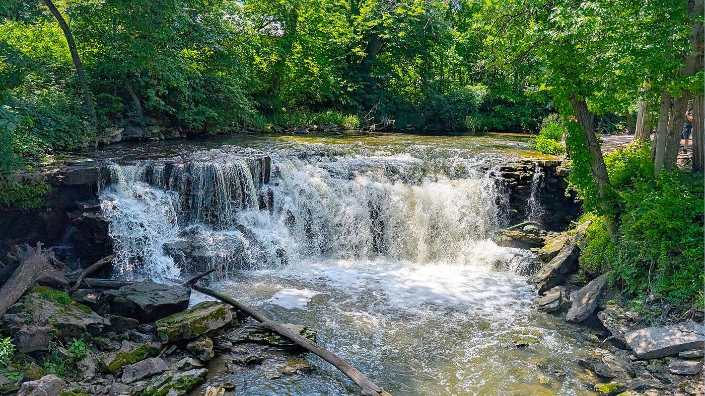
In the southern section of Minneopa State Park, park at the gravel lot at the end of the road. Follow the paved path past the picnic area to the footbridge between the two drops. For the lower falls, the trail runs along the top of the gorge and then down limestone steps to a sandy, rocky path along the creek bank. Return the same way.
Plan your visit
Minneopa State Park waterfalls area trail from the south-section parking lot
The DNR map lists the Waterfalls Area trail as 0.18 miles one-way. A 2018 Day Hiking Trails account gives 0.4-mile round trip.
Cement and dirt paths with steep stairs, then a sandy and rocky creekside trail.
Where to start
From US 169 west of Mankato, turn north on County Road 69 (Gadwall Road), take the first left after entering the park, and park in the gravel lot at the road end.
Timing & water
The DNR map lists the park open 8 a.m. to 10 p.m. daily and asks visitors to respect trail closures. Current stair or lower-trail closures were not verified.
Before you go
A Minnesota state park vehicle permit is required; the DNR map says to buy it at the park office or self-pay station.
Visitor informationVisit sources
More waterfalls nearby
Within 40 straight-line miles. Road and trail distances will differ.
 Upper Minneopa FallsShort state park walk; vehicle permit required20 ft (6 m) · Blue Earth County, MN0.0 miW
- Minnemishinona FallsRoadside bridge overlook42 ft (12.8 m) · Nicollet County, MN1.5 miN
- Triple FallsBlue Earth County, MN2.5 miSW
- Minnewankon FallsNicollet County, MN2.5 miN
- Bigger Manitou FallsBlue Earth County, MN3.7 miSW
- Swan Lake FallNicollet County, MN6.6 miNW